On March 9, Russia celebrates the Day of Geodesy and Cartography Workers. Denis Krivoguz, a leading researcher at the Department of Oceanology at the SFedU Institute of Earth Sciences, talks about the relevance and prospects of the sphere.
His research is aimed at solving practical problems in ecology, urbanism and agriculture using modern geospatial technologies and analytical methods.
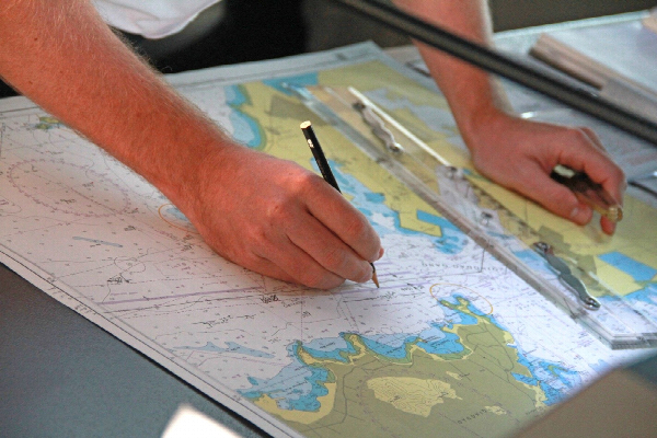
The use of maps has been known since ancient times. The first attempts to capture the surrounding reality appear back in ancient Babylon, for example, archaeologists found a clay tablet from about the end of the VIII — beginning of the VII century BC, which depicted the Greek city and states of Assyria, Urartu. Since then, cartography has become a real science, complex and multitasking, the purpose of which is not only to show exactly where and how an object is located, but also to describe its properties in more detail, analyze its transformation, etc. Digitalization, artificial intelligence, space data and much more are coming to the aid of cartographers.
The Institute of Earth Sciences is engaged in this field at the Southern Federal University. It not only trains highly qualified specialists with expertise in geodesy and cartography, but also engages in relevant research and development related to ecology, urbanism, climatology, geology and geodesy, etc.
As Denis Krivoguz notes, the scientific field is undergoing rapid development due to the introduction of advanced technologies. One of the key areas was the integration of geographic information systems (GIS), remote sensing of the Earth (remote sensing), artificial intelligence and machine learning.
"Modern cartography is undergoing significant transformations due to the introduction of advanced technologies that radically improve the accuracy, detail and relevance of maps. One of the key technologies is geoinformation systems, which allow not only visualizing spatial data, but also analyzing it in real time," said the SFedU scientist.

Satellite systems such as Sentinel, Landsat, Resurs, and Canopus provide detailed images, which is especially important for tracking natural changes, including desertification, deforestation, and reservoir dynamics. Innovative technologies such as laser scanning (LIDAR) make it possible to create accurate 3D models of an area, which is critically important for urbanism and environmental research.
"An important breakthrough relatively recently was the use of LIDAR, which uses laser scanning to create three-dimensional terrain models with an accuracy of several centimeters. This technology is indispensable for mapping complex landscapes such as forests, mountainous regions or urban areas."
According to the scientist, the contribution of AI and machine learning is equally significant. Algorithms automatically analyze huge amounts of data, such as recognizing objects in images, predicting landscape changes, or filtering out noise in the data. This speeds up information processing and reduces the risk of human error, increasing the accuracy of maps.
However, with the development of technology, cartography faces new challenges. One of them is processing huge amounts of data coming from various platforms: satellites, drones, and IoT devices. This requires powerful computing resources and data standardization.

Cartography also plays an important role in education and popularization of science. Modern digital maps help young people better understand the world around them and study global processes such as climate change or urban growth.
"Modern maps, especially digital and interactive ones, have become a bridge between abstract concepts and the real world, helping students visualize processes such as climate change, urbanization, or ecosystem dynamics," emphasizes Denis Krivoguz.
Cartography also plays a key role in urban studies. In the project "Geo-spatial analysis of urbanization and environmental changes with deep neural networks", SFedU scientists used deep neural networks to process long-term satellite images. This helped to assess the pace of urbanization and its impact on the environment. Such maps allow urban planners to optimize the zoning of territories and reduce the negative effects of infrastructure interaction with natural areas.
In agriculture, cartographic methods help to solve important issues. The university's study "Machine Learning Approach for Detection of Water Overgrowth in Azov Sea" demonstrates how machine learning algorithms based on Sentinel-2 satellite data determine the overgrowth of reservoirs. This helps farmers to control the dynamics of waterlogging and reduction of water areas, plan land reclamation and prevent a decrease in yields. Cartography is also indispensable in climatology.
"My work focuses on analyzing the interrelationships between climate change and the transformation of natural and anthropogenic systems. In the article "Enhancing long-term air temperature forecasting with deep learning architectures", we use deep neural networks to process long-term observational data. This increases the accuracy of climate models, which is critically important for the adaptation of infrastructure and agriculture," says the scientist.
The SFedU study "Assessing Long-Term Lake Dynamics in Response to Climatic Variability" uses remote sensing data and statistical methods to identify changes in precipitation and temperature affecting aquatic ecosystems. The results of these studies help to develop strategies for sustainable resource management, minimize the risks of extreme weather events, and preserve biodiversity.

Cartography continues to evolve, becoming an important tool for science, business, and government agencies. Its influence extends to a wide variety of areas, from environmental monitoring and natural resource management to urban planning and logistics. Every year, technology makes maps more accurate and their application broader, which opens up new perspectives for exploring and transforming the world around us.
Short link to this page sfedu.ru/news/77410


